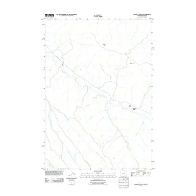
2011 Map of Cedar Canyon
USGS Topo · Published 2011About this map
The NX Bar Ranch serves as a prominent landmark in this sparsely settled corner of Sheridan County, Wyoming, reflecting the enduring presence of ranching culture in the High Plains. The landscape is defined by the drainage networks of Badger Creek and its various tributaries, including Hill Prong Badger Creek and the West Fork Little Badger Creek. This terrain is characterized by the Badger Hills, which rise above named topographical features like Riley Draw and Windmill Draw. Transport through this open country relies on a few critical corridors such as Badger Creek Rd and Spring Willow Creek Rd, which follow the natural contours of the watercourses. The map captures a moment in the early 21st century where the primary human footprint is found in these isolated ranching operations and the simple infrastructure required to navigate the expansive draws and ridges.
Find a feature on this map
11 named features on this map. Tap any name to fly to it.
Don’t see what you’re looking for? This feature index may not catch every label — zoom into the map to look around manually.
Map Details
Editions of this 2011 Cedar Canyon Map
This is the sole edition of this map. No revisions or reprints were ever made.
Other maps of this area

1909 · Sheridan
USGS Topo · 1:125,000

1911 · Sheridan
USGS Topo · 1:125,000

1954 · Hardin
USGS Topo · 1:250,000

1955 · Sheridan
USGS Topo · 1:250,000

1957 · Hardin
USGS Topo · 1:250,000

1958 · Hardin
USGS Topo · 1:250,000

1958 · Sheridan
USGS Topo · 1:250,000

1962 · Sheridan
USGS Topo · 1:250,000

1967 · Holmes Ranch
USGS Topo · 1:24,000
1967 · Pine Butte School
USGS Topo · 1:24,000