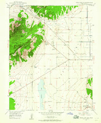
1949 Map of Cedar City NW
USGS Topo · Published 1960About this map
Granite Mountain dominates the western landscape of this 1949 survey, its steep slopes concealing a series of historic mining operations. The rugged terrain transitions abruptly into the Cedar Valley, where the industrial and transport infrastructure of Iron County is clearly visible. The Union Pacific line cuts diagonally across the valley floor, connecting the settlement at Iron Springs with the broader rail network. To the south, Quichapa Lake sits within a low-lying basin known as The Bottoms, illustrating the drainage patterns that define this high desert environment. The presence of several inactive sites, such as the Great Western Mine (Inactive) and Armstrong Mine (Inactive), alongside active prospects like the Smith Mine, reflects the era's shifting mining economy. Small community hubs and landmarks, including the KSUB Radio Towers and the settlement of Hamiltons Fort, provide key reference points for local history and genealogical research.
Find a feature on this map
26 named features on this map. Tap any name to fly to it.
Don’t see what you’re looking for? This feature index may not catch every label — zoom into the map to look around manually.
Map Details
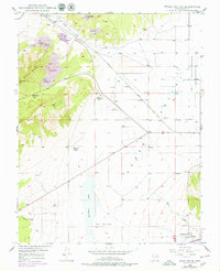
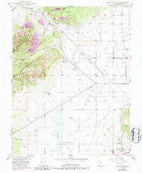
Editions of this 1949 Cedar City NW Map
4 editions found
Other maps of this area

1885 · St. George
USGS Topo · 1:250,000

1891 · St. George
USGS Topo · 1:250,000

1949 · Cedar City NW
USGS Topo · 1:24,000

1950 · Cedar City NW
USGS Topo · 1:24,000

1950 · Kanarraville
USGS Topo · 1:24,000

1950 · Enoch
USGS Topo · 1:24,000

1950 · Cedar City
USGS Topo · 1:24,000

1950 · Enoch
USGS Topo · 1:62,500

1950 · Iron Mountain
USGS Topo · 1:62,500

1950 · Cedar City
USGS Topo · 1:62,500