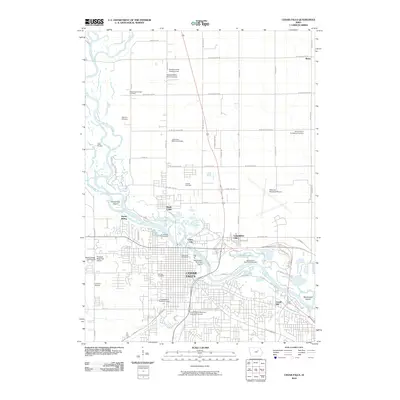
2010 Map of Cedar Falls
USGS Topo · Published 2010About this map
Cedar Falls and the neighboring community of Waterloo Municipal Airport are defined by the winding course of the Cedar River and its various tributaries like Snag Creek and Dry Run. This 2010 topographic record highlights the significant footprint of the University of Northern Iowa and its campus facilities, including the University of Northern Iowa Golf Course. The map captures the distinct residential pockets and industrial sidings that have shaped the urban geography of Black Hawk County, with locations such as North Cedar, Cedar City, and Castle Hill flanking the riverbanks.
Find a feature on this map
60 named features on this map. Tap any name to fly to it.
Don’t see what you’re looking for? This feature index may not catch every label — zoom into the map to look around manually.
Map Details
Editions of this 2010 Cedar Falls Map
This is the sole edition of this map. No revisions or reprints were ever made.
Other maps of this area

1954 · Waterloo
USGS Topo · 1:250,000

1955 · Waterloo
USGS Topo · 1:250,000

1963 · Waverly
USGS Topo · 1:24,000

1963 · Denver
USGS Topo · 1:24,000

1963 · Hudson
USGS Topo · 1:24,000

1963 · Waterloo South
USGS Topo · 1:24,000

1963 · Cedar Falls
USGS Topo · 1:24,000

1963 · Waterloo North
USGS Topo · 1:24,000

1971 · Zaneta
USGS Topo · 1:24,000

1971 · Shell Rock
USGS Topo · 1:24,000