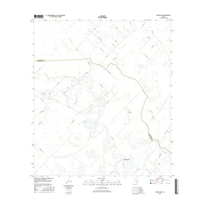
2016 Map of Cedar Lane
USGS Topo · Published 2016About this map
Caney Creek and Cedar Lake Creek wind through the coastal lowlands of the Texas Gulf Coast, defining a landscape of complex hydrology and agricultural drainage. This 2016 survey highlights the intricate network of water bodies such as Linnville Bayou, Lake Bowie, and Dead Slough that characterize the area around the settlement of Cedar Lane. The terrain is notably flat, including the aptly named Ash Flat, with numerous small ponds and wetlands scattered between the primary creek channels.
Find a feature on this map
49 named features on this map. Tap any name to fly to it.
Don’t see what you’re looking for? This feature index may not catch every label — zoom into the map to look around manually.
Map Details
Editions of this 2016 Cedar Lane Map
This is the sole edition of this map. No revisions or reprints were ever made.
Other maps of this area

1950 · Houston
USGS Topo · 1:250,000

1951 · Bay City
USGS Topo · 1:250,000

1952 · Sweeny
USGS Topo · 1:24,000

1952 · Ashwood
USGS Topo · 1:24,000

1952 · Lake Austin
USGS Topo · 1:24,000

1952 · Cedar Lane NE
USGS Topo · 1:24,000

1952 · Cedar Lakes West
USGS Topo · 1:24,000

1952 · Bay City NE
USGS Topo · 1:24,000

1952 · Brazoria
USGS Topo · 1:24,000

1952 · Cedar Lane
USGS Topo · 1:24,000