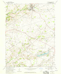
1968 Map of Cedarville
USGS Topo · Published 1970About this map
Cedarville College serves as a prominent landmark in this Greene County landscape, situated near the confluence of the North Fork and South Fork of Massies Creek. The area's mid-century transportation and industrial character is defined by the intersection of the Penn Central and Baltimore and Ohio railroads, which linked small agricultural and academic hubs like Wilberforce and New Jasper. A distinctive local landmark, the Cedar Cliff limestone formation rises near a local quarry, indicating the geologic underpinnings that supported regional industry.
Find a feature on this map
40 named features on this map. Tap any name to fly to it.
Don’t see what you’re looking for? This feature index may not catch every label — zoom into the map to look around manually.
Map Details
Editions of this 1968 Cedarville Map
3 editions found
Other maps of this area

1904 · Springfield
USGS Topo · 1:62,500

1906 · Springfield
USGS Topo · 1:62,500

1907 · South Charleston
USGS Topo · 1:62,500

1916 · Octa
USGS Topo · 1:62,500

1917 · Xenia
USGS Topo · 1:62,500

1944 · Octa
USGS Topo · 1:62,500

1947 · Columbus
USGS Topo · 1:250,000

1954 · Clifton
USGS Topo · 1:24,000

1955 · New Burlington
USGS Topo · 1:24,000
1955 · Yellow Springs
USGS Topo · 1:24,000
Featured Places
- Xenia, OH
- Cedarville, Cedarville Township
- New Jasper, New Jasper Township
- Jamestown, Silvercreek Township
- Ross Township, OH