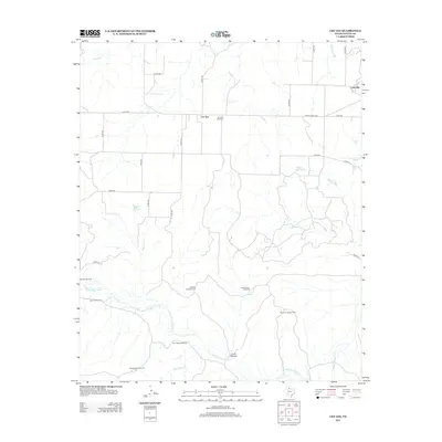
2012 Map of Cee Vee
USGS Topo · Published 2012About this map
Cee Vee and the surrounding Cottle County ranch lands are defined by the winding course of the Middle Pease River and its numerous seasonal tributaries. The landscape is a network of named canyons and creeks, including Lone Canyon, Raggedy Cr, and Cow Hollow Cr. This area of Northwest Texas maintains its identity through scattered landmarks essential to rural life, such as the Haven of Rest Cem and several water-management features like Raggedy Tank and Willow Hole Tank.
Find a feature on this map
34 named features on this map. Tap any name to fly to it.
Don’t see what you’re looking for? This feature index may not catch every label — zoom into the map to look around manually.
Map Details
Editions of this 2012 Cee Vee Map
This is the sole edition of this map. No revisions or reprints were ever made.
Other maps of this area

1954 · Plainview
USGS Topo · 1:250,000

1958 · Plainview
USGS Topo · 1:250,000

1966 · Fields Canyon
USGS Topo · 1:24,000

1966 · Cee Vee
USGS Topo · 1:24,000

1966 · Tee Pee City
USGS Topo · 1:24,000

1966 · Devils Canyon
USGS Topo · 1:24,000

1967 · Tell South
USGS Topo · 1:24,000

1967 · Hell Roaring Creek
USGS Topo · 1:24,000

1967 · Dunlap
USGS Topo · 1:24,000

1967 · Northfield
USGS Topo · 1:24,000