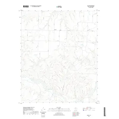
2019 Map of Cee Vee
USGS Topo · Published 2019About this map
Cee Vee sits at the intersection of several rural routes in Cottle County, marking a localized center of activity in this expansive North Texas landscape. The settlement is anchored by the Haven of Rest Cem, located just off Ranch Rd 1440. The topography is defined by the braided channels of the Middle Pease River, which winds through the southern portion of the quadrangle. North of the river, the terrain is cut by deep drainage features like Lone Canyon and numerous creeks such as Raggedy Cr and Cow Hollow Cr. The presence of Raggedy Tank and Willow Hole Tank highlights the importance of water management in this cattle-ranching region, where intermittent streams like Bluff Cr and Richland Cr feed into the larger Pease River system. The grid of county roads provides a look at the land division and access points to the various ranches that define this part of the Texas Rolling Plains.
Find a feature on this map
27 named features on this map. Tap any name to fly to it.
Don’t see what you’re looking for? This feature index may not catch every label — zoom into the map to look around manually.
Map Details
Editions of this 2019 Cee Vee Map
This is the sole edition of this map. No revisions or reprints were ever made.
Other maps of this area

1954 · Plainview
USGS Topo · 1:250,000

1958 · Plainview
USGS Topo · 1:250,000

1966 · Fields Canyon
USGS Topo · 1:24,000

1966 · Cee Vee
USGS Topo · 1:24,000

1966 · Tee Pee City
USGS Topo · 1:24,000

1966 · Devils Canyon
USGS Topo · 1:24,000

1967 · Tell South
USGS Topo · 1:24,000

1967 · Hell Roaring Creek
USGS Topo · 1:24,000

1967 · Dunlap
USGS Topo · 1:24,000

1967 · Northfield
USGS Topo · 1:24,000