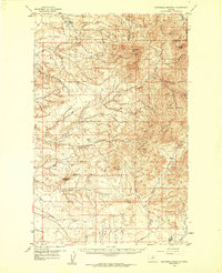
1959 Map of Centennial Mountain
USGS Topo · Published 1961About this map
The Rocky Boy Indian Reservation dominates the northern reaches of this landscape, encompassing the high peaks of the Bearpaw Mountains. Land use is defined by a sharp contrast between the prominent summits like Centennial Mountain and the series of drainage coulees and creeks that carve through the surrounding terrain. Small-scale industry is evidenced by a Coal Mine and several other unlabeled Mine sites tucked into the hills, indicating localized extraction in an otherwise sparsely settled environment.
Find a feature on this map
30 named features on this map. Tap any name to fly to it.
Don’t see what you’re looking for? This feature index may not catch every label — zoom into the map to look around manually.
Map Details
Editions of this 1959 Centennial Mountain Map
3 editions found

Other maps of this area

1890 · Fort Benton
USGS Topo · 1:250,000

1892 · Fort Benton
USGS Topo · 1:250,000

1897 · Fort Benton
USGS Topo · 1:250,000

1904 · Boxelder
USGS Topo · 1:62,500

1906 · Boxelder
USGS Topo · 1:62,500

1919 · Big Sandy
USGS Topo · 1:125,000

1953 · Lonetree Coulee
USGS Topo · 1:24,000

1953 · Pilot Rock
USGS Topo · 1:24,000

1953 · Havre
USGS Topo · 1:250,000

1954 · Great Falls
USGS Topo · 1:250,000