
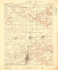
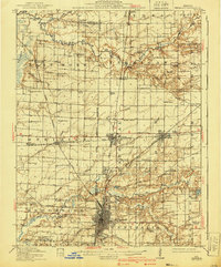
1914 Map of Centralia
USGS Topo · Published 1914About this map
Centralia stands as a significant railroad hub in the early twentieth century, where the tracks of the Illinois Central RR, Southern RR, and Chicago Burlington and Quincy converge. This survey captures a landscape defined by its grid of rural schools, such as the curiously named Possumtrot School, Red Stripe School, and Watson Springs School, illustrating the density of small communities like Sandoval and Odin before modern consolidation.
Find a feature on this map
91 named features on this map. Tap any name to fly to it.
Don’t see what you’re looking for? This feature index may not catch every label — zoom into the map to look around manually.
Map Details
Editions of this 1914 Centralia Map
3 editions found
Other maps of this area

1910 · Carlyle
USGS Topo · 1:62,500

1931 · Hoyleton
USGS Topo · 1:48,000

1932 · Greenville
USGS Topo · 1:62,500

1932 · Nashville
USGS Topo · 1:62,500

1933 · Mount Vernon
USGS Topo · 1:48,000

1934 · Salem
USGS Topo · 1:62,500

1935 · Centralia
USGS Topo · 1:62,500

1936 · Nashville
USGS Topo · 1:62,500

1938 · Salem
USGS Topo · 1:62,500

1939 · Greenville
USGS Topo · 1:62,500