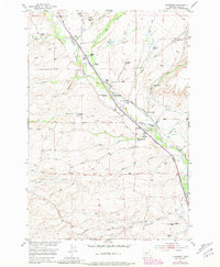
1951 Map of Chadborn
USGS Topo · Published 1981About this map
Shields River flows through the heart of the Shields Valley in this mid-century topographic survey, showing a landscape defined by an extensive network of family-owned ranching operations. The Burlington Northern railroad corridor parallels the river, providing the vital transportation link for the small settlement at Chadborn and the nearby Cowan School. The map reveals the intricate water management systems essential to the valley, including the Palmer Ditch and Clyde Park Ditch, which redirect water from various creeks to support the local agricultural economy. Named holdings like the Tregloan Ranch, Francis Brothers Ranch, and Keys Brothers Ranch are clearly identified, offering valuable data for genealogists tracing legacy families in Park County. The southern portion of the sheet is marked by the Base Line, where the terrain begins to transition into the drainage areas of Willow Creek and Crazyhead Creek.
Find a feature on this map
44 named features on this map. Tap any name to fly to it.
Don’t see what you’re looking for? This feature index may not catch every label — zoom into the map to look around manually.
Map Details
Editions of this 1951 Chadborn Map
4 editions found
Other maps of this area

1891 · Livingston
USGS Topo · 1:250,000

1893 · Livingston
USGS Topo · 1:250,000

1947 · Bozeman
USGS Topo · 1:250,000

1948 · Bozeman
USGS Topo · 1:250,000

1951 · Ibex Mountain
USGS Topo · 1:24,000

1951 · Gobblers Knob
USGS Topo · 1:24,000

1951 · Clyde Park
USGS Topo · 1:24,000

1951 · Chadborn
USGS Topo · 1:24,000

1951 · Grannis
USGS Topo · 1:24,000

1951 · Hoppers
USGS Topo · 1:24,000