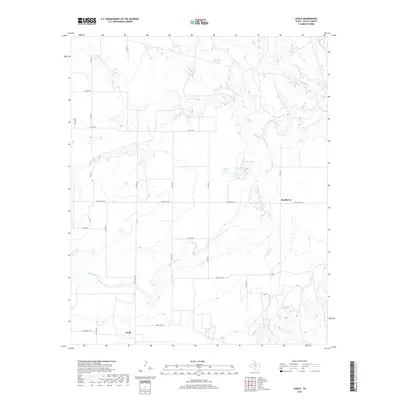
2019 Map of Chalk
USGS Topo · Published 2019About this map
Chalk and Hackberry sit within the drainage of the N Wichita River in this part of Cottle County. The landscape is defined by the convergence of multiple seasonal watercourses, most notably Buffalo Cr and Salt Cr, which carve through the terrain before meeting the river. Human presence is largely marked by an extensive grid of rural roads and ranches, such as Ranch Rd 1038 and Ranch Rd 3102, reflecting the region's enduring ranching economy. Notable water features like Worley Lake and the smaller L V Worley Lake provide rare catchments in an area also characterized by the presence of Salt Spring. This documentation of the watershed, including Cottonwood Cr in the northeast, shows a sparsely populated but carefully divided territory where land use is dictated by the availability of water and the winding paths of the creek beds.
Find a feature on this map
30 named features on this map. Tap any name to fly to it.
Don’t see what you’re looking for? This feature index may not catch every label — zoom into the map to look around manually.
Map Details
Editions of this 2019 Chalk Map
This is the sole edition of this map. No revisions or reprints were ever made.
Other maps of this area

1954 · Lubbock
USGS Topo · 1:250,000

1954 · Plainview
USGS Topo · 1:250,000

1958 · Plainview
USGS Topo · 1:250,000

1966 · Chalk SW
USGS Topo · 1:24,000

1966 · Lowrance Mountain
USGS Topo · 1:24,000

1967 · Triangle Ranch
USGS Topo · 1:24,000

1967 · Paducah
USGS Topo · 1:24,000

1967 · Moons Camp
USGS Topo · 1:24,000

1968 · Y Ranch
USGS Topo · 1:24,000

1968 · Grow
USGS Topo · 1:24,000