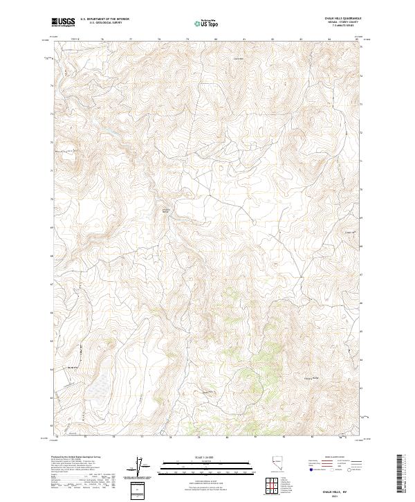
2021 Map of Chalk Hills
USGS Topo · Published 2021About this map
The Chalk Hills define this high-desert landscape in Storey County, where a network of unpaved tracks and modern roads snakes through complex topography. The map reveals a transition from the Virginia Range in the center toward the Flowery Range in the southeast, a region historically shaped by mining and ranching interests in western Nevada. Landmarks like Clark Mtn and Washington Hill anchor the higher elevations, while drainage is handled by features such as Long Valley Cr. The presence of recently named residential access roads like Dry Lake Cir, Cartwright Rd, and Bullfrog Rd suggests modern subdivision or rural development encroaching on the traditional open range. This 2021 study provides a clear view of how contemporary access intersects with the enduring peaks of Cinder Mtn and the surrounding basin.
Find a feature on this map
16 named features on this map. Tap any name to fly to it.
Don’t see what you’re looking for? This feature index may not catch every label — zoom into the map to look around manually.
Map Details
Editions of this 2021 Chalk Hills Map
This is the sole edition of this map. No revisions or reprints were ever made.
Other maps of this area

1890 · Wadsworth
USGS Topo · 1:125,000

1891 · Carson
USGS Topo · 1:125,000

1891 · Wabuska
USGS Topo · 1:125,000

1891 · Reno
USGS Topo · 1:125,000

1892 · Wadsworth
USGS Topo · 1:125,000

1893 · Carson
USGS Topo · 1:125,000

1893 · Reno
USGS Topo · 1:125,000

1894 · Wadsworth
USGS Topo · 1:125,000

1894 · Wabuska
USGS Topo · 1:125,000

1950 · Virginia City
USGS Topo · 1:62,500