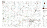
1985 Map of Champaign
USGS Topo · Published 1986About this map
The agricultural heartland of Central Illinois is dominated by the sprawling twin cities of Bloomington and Normal in the northwest, alongside the academic and urban centers of Champaign and Urbana to the southeast. During the mid-1980s, this region was a critical crossroads for the Illinois Central Gulf, Norfolk and Western, and Conrail railroads, which facilitated the movement of grain from the surrounding prairie townships. Notable landmarks include the extensive Chanute Air Force Base near Rantoul and significant natural preserves like Moraine View State Park and Robert Allerton Park. The landscape is defined by its glacial heritage, seen in features like Blue Ridge and Blue Mound, and drained by the Sangamon River and its various sloughs. Smaller rail-dependent settlements such as Gibson City, Saybrook, and Bellflower dot the grid, representing the mid-century peak of the regional transport network before later consolidation.
Find a feature on this map
196 named features on this map. Tap any name to fly to it.
Don’t see what you’re looking for? This feature index may not catch every label — zoom into the map to look around manually.
Map Details
Editions of this 1985 Champaign Map
2 editions found
Other maps of this area

1906 · Urbana
USGS Topo · 1:62,500

1907 · Mahomet
USGS Topo · 1:62,500

1924 · Paxton
USGS Topo · 1:62,500

1926 · Normal
USGS Topo · 1:62,500

1927 · Paxton
USGS Topo · 1:62,500

1927 · Danvers
USGS Topo · 1:62,500

1928 · Gibson City
USGS Topo · 1:62,500

1929 · Decatur
USGS Topo · 1:62,500

1930 · Danvers
USGS Topo · 1:62,500

1930 · Normal
USGS Topo · 1:62,500