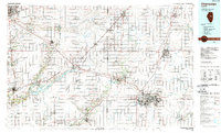
1985 Map of Champaign
USGS Topo · Published 1989About this map
The Sangamon River and its numerous tributaries, including Madden Creek and Camp Creek, carve through the agricultural heart of Central Illinois. This 1980s landscape is defined by the significant footprint of the Illinois Central Gulf and Norfolk and Western railroads, which connected the major hubs of Bloomington, Normal, and Rantoul. The presence of Chanute Air Force Base highlights the region's strategic military importance during the late 20th century.
Find a feature on this map
138 named features on this map. Tap any name to fly to it.
Don’t see what you’re looking for? This feature index may not catch every label — zoom into the map to look around manually.
Map Details
Editions of this 1985 Champaign Map
2 editions found
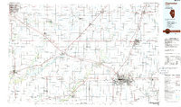
Other maps of this area

1906 · Urbana
USGS Topo · 1:62,500

1907 · Mahomet
USGS Topo · 1:62,500

1924 · Paxton
USGS Topo · 1:62,500

1926 · Normal
USGS Topo · 1:62,500

1927 · Paxton
USGS Topo · 1:62,500

1927 · Danvers
USGS Topo · 1:62,500

1928 · Gibson City
USGS Topo · 1:62,500

1929 · Decatur
USGS Topo · 1:62,500

1930 · Danvers
USGS Topo · 1:62,500

1930 · Normal
USGS Topo · 1:62,500