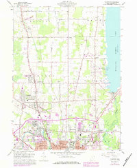
1960 Map of Champion
USGS Topo · Published 1979About this map
Warren and its northern suburbs anchor this map, where the industrial presence of the Mahoning River meets the expansive waters of Mosquito Creek Lake. The landscape is characterized by its transition from the urban grid of the northern city limits into the township layouts of the Connecticut Western Reserve. Small named corners such as Hoagland Corner, Wilhelm Corner, and Hardscrabble define the rural crossroads, while the Conrail and Baltimore and Ohio railroads cut through the terrain, supporting the heavy industry evidenced by a Slag Pile and Quarry. Local genealogy is well-documented through numerous sites like Champion Center Cem and the Bazetta Sch. The establishment of Mosquito Creek State Park marks the eastern boundary, illustrating the area's development for recreation alongside its established rail and manufacturing corridors.
Find a feature on this map
53 named features on this map. Tap any name to fly to it.
Don’t see what you’re looking for? This feature index may not catch every label — zoom into the map to look around manually.
Map Details
Editions of this 1960 Champion Map
5 editions found

Other maps of this area

1905 · Bristolville
USGS Topo · 1:62,500

1906 · Youngstown
USGS Topo · 1:62,500

1907 · Kinsman
USGS Topo · 1:62,500

1907 · Bristolville
USGS Topo · 1:62,500

1908 · Youngstown
USGS Topo · 1:62,500

1908 · Warren
USGS Topo · 1:62,500

1950 · Cleveland
USGS Topo · 1:250,000

1952 · West Farmington
USGS Topo · 1:24,000

1952 · Southington
USGS Topo · 1:24,000

1954 · Girard
USGS Topo · 1:24,000