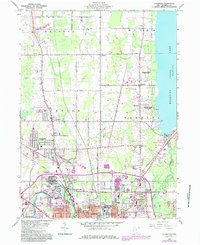
1960 Map of Champion
USGS Topo · Published 1985About this map
The northern industrial and residential expansion of Warren into the Connecticut Western Reserve is documented in this survey, highlighting the transition from urban density to the rural townships of Champion and Bazetta. The southern edge of the map is dominated by the industrial character of Warren, featuring the Mahoning River and a dense network of rail lines including Conrail and the Baltimore and Ohio. To the east, the shoreline of the Mosquito Creek reservoir is framed by Mosquito Creek State Park, which represents a significant shift in land use towards recreation.
Find a feature on this map
36 named features on this map. Tap any name to fly to it.
Don’t see what you’re looking for? This feature index may not catch every label — zoom into the map to look around manually.
Map Details
Editions of this 1960 Champion Map
5 editions found

Other maps of this area

1905 · Bristolville
USGS Topo · 1:62,500

1906 · Youngstown
USGS Topo · 1:62,500

1907 · Kinsman
USGS Topo · 1:62,500

1907 · Bristolville
USGS Topo · 1:62,500

1908 · Youngstown
USGS Topo · 1:62,500

1908 · Warren
USGS Topo · 1:62,500

1950 · Cleveland
USGS Topo · 1:250,000

1952 · West Farmington
USGS Topo · 1:24,000

1952 · Southington
USGS Topo · 1:24,000

1954 · Girard
USGS Topo · 1:24,000