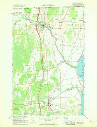
1966 Map of Champlain
USGS Topo · Published 1968About this map
The Canada United States border defines the northern edge of this mid-1960s survey, where the Adirondack Northway cuts south through the heart of the landscape. Centered on the village of Champlain, the region is a network of agricultural land and early industrial traces along the Great Chazy River. Local genealogy is well-represented through numerous sites like St Marys Cem, Maple Hill Cem, and Sacred Heart Cem, alongside civic hubs like the Champlain Central High Sch.
Find a feature on this map
51 named features on this map. Tap any name to fly to it.
Don’t see what you’re looking for? This feature index may not catch every label — zoom into the map to look around manually.
Map Details
Editions of this 1966 Champlain Map
2 editions found
Other maps of this area

1895 · Mooers
USGS Topo · 1:62,500

1895 · Rouse Point
USGS Topo · 1:62,500

1899 · Mooers
USGS Topo · 1:62,500

1907 · Rouse Point
USGS Topo · 1:62,500

1939 · Rouses Point
USGS Topo · 1:62,500

1942 · Mooers
USGS Topo · 1:62,500

1943 · Mooers
USGS Topo · 1:62,500

1943 · Rouses Point
USGS Topo · 1:62,500

1950 · Lake Champlain
USGS Topo · 1:250,000

1956 · Rouses Point
USGS Topo · 1:62,500