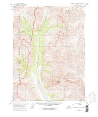
1971 Map of Chandalar D-6
USGS Topo · Published 1997About this map
Gates of the Arctic National Park encompasses the western portion of this landscape, established as the North Slope Borough Boundary cuts across the northern terrain. The central corridor is dominated by the Dietrich River, which flows through a wide valley flanked by the towering heights of Table Mountain and Snowden Mountain. A defining feature of this era is the inclusion of The Trans-Alaska Pipeline, shown tracing the river valley. This infrastructure represents a significant shift in the land use of the Brooks Range during the early 1970s, as industrial development intersected with pristine wilderness. Numerous tributaries, including Kuyuktuvuk Creek, Nutirwik Creek, and Mathews River, carve through the high-elevation topography, illustrating the complex drainage patterns that define this subarctic environment before more modern modifications.
Find a feature on this map
12 named features on this map. Tap any name to fly to it.
Don’t see what you’re looking for? This feature index may not catch every label — zoom into the map to look around manually.
Map Details
Editions of this 1971 Chandalar D-6 Map
3 editions found
Other maps of this area

1951 · Chandler Lake
USGS Topo · 1:250,000

1951 · Chandalar
USGS Topo · 1:250,000

1951 · Brooks
USGS Topo · 1:250,000

1951 · Wiseman
USGS Topo · 1:250,000

1956 · Chandalar
USGS Topo · 1:250,000

1956 · Wiseman
USGS Topo · 1:250,000

1956 · Philip Smith Mountains
USGS Topo · 1:250,000

1956 · Chandler Lake
USGS Topo · 1:250,000

1964 · Wiseman
USGS Topo · 1:250,000

1964 · Chandalar
USGS Topo · 1:250,000