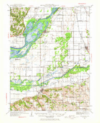
1930 Map of Chandlerville
USGS Topo · Published 1967About this map
The Illinois River and Sangamon River dominate this landscape, creating a complex network of backwater lakes and sloughs that shaped local life between the wars. This era shows a river-and-rail economy in transition, where the Chicago and Illinois Midland railroad cuts through the eastern prairie while older riverfront settlements like Bath and Snicarte maintain their connections to the water via Bath Chute and the Snicarte Slough.
Find a feature on this map
123 named features on this map. Tap any name to fly to it.
Don’t see what you’re looking for? This feature index may not catch every label — zoom into the map to look around manually.
Map Details
Editions of this 1930 Chandlerville Map
2 editions found
Other maps of this area

1909 · Tallula
USGS Topo · 1:62,500

1918 · Vermont
USGS Topo · 1:62,500

1921 · Vermont
USGS Topo · 1:62,500

1925 · Havana
USGS Topo · 1:62,500

1926 · Beardstown
USGS Topo · 1:62,500

1929 · Arenzville
USGS Topo · 1:62,500

1929 · Manito
USGS Topo · 1:62,500

1930 · Chandlerville
USGS Topo · 1:62,500

1932 · Arenzville
USGS Topo · 1:62,500

1932 · Chandlerville
USGS Topo · 1:62,500