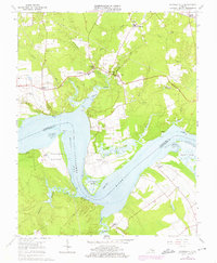
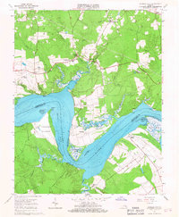
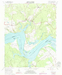
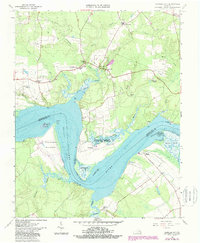
1965 Map of Charles City
USGS Topo · Published 1975About this map
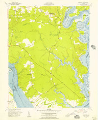
Charles City stands near the center of this Tidewater Virginia landscape, where the historic Tidewater estates and colonial-era land grants meet the tidal reach of the James River. The geography is defined by the sweeping Three Mile Reach and the complex drainage of Kittewan Creek, Mapsico Creek, and Tyler Creek. Significant cultural landmarks include the storied Sherwood Forest and Upper Brandon plantations, which anchor the opposite banks of the river. The map details a 1960s rural infrastructure of schools and churches, such as Elam Ch and Parrish Hill Ch, alongside legacy sites like Fort Powhatan and Willcox Wharf. This documentation of the Peninsula and Southside reflects an era when the primary transportation corridors, including Courthouse Road, still mirrored the plantation-to-landing patterns established centuries prior.
Find a feature on this map
52 named features on this map. Tap any name to fly to it.
Don’t see what you’re looking for? This feature index may not catch every label — zoom into the map to look around manually.
Map Details
Editions of this 1965 Charles City Map
4 editions found
Other maps of this area

1917 · Toano
USGS Topo · 1:62,500

1918 · Charles City
USGS Topo · 1:62,500

1918 · Toano
USGS Topo · 1:62,500

1919 · Surry
USGS Topo · 1:62,500

1919 · Disputanta
USGS Topo · 1:62,500

1943 · Savedge
USGS Topo · 1:31,680

1943 · Disputanta
USGS Topo · 1:31,680

1943 · Richmond
USGS Topo · 1:250,000

1949 · Richmond
USGS Topo · 1:250,000
1952 · Brandon
USGS Topo · 1:24,000