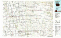
1985 Map of Charles City
USGS Topo · Published 1990About this map
Charles City serves as the focal point of this North Central Iowa landscape, situated at the confluence of the Cedar River and Spring Creek. The 1980s terrain is defined by its agricultural grid and a robust network of railways, including the Chicago and North Western and the Illinois Central Gulf. While larger settlements like Osage and Nora Springs anchor their respective townships, smaller communities such as Stacyville Junction, Toeterville, and Lourdes provide insight into the rural social fabric of the era. Significant conservation areas like the Hayden Prairie State Wildlife Management Area and Wapsi River State Wildlife Management Area break the geometric pattern of the farmland. For genealogists, the map preserves the locations of local landmarks such as Eden Church and Oak Lawn Cem, alongside numerous small quarries and municipal airports like Mosher Airport.
Find a feature on this map
140 named features on this map. Tap any name to fly to it.
Don’t see what you’re looking for? This feature index may not catch every label — zoom into the map to look around manually.
Map Details
Editions of this 1985 Charles City Map
2 editions found
Other maps of this area

1901 · Oelwein
USGS Topo · 1:125,000

1906 · Decorah
USGS Topo · 1:125,000

1954 · Hayward
USGS Topo · 1:62,500

1954 · Austin
USGS Topo · 1:62,500

1954 · Mason City
USGS Topo · 1:250,000

1954 · Waterloo
USGS Topo · 1:250,000

1955 · Waterloo
USGS Topo · 1:250,000

1957 · Mason City
USGS Topo · 1:250,000

1958 · Mason City
USGS Topo · 1:250,000

1958 · La Crosse
USGS Topo · 1:250,000