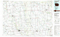
1985 Map of Charles City
USGS Topo · Published 1985About this map
The Cedar River and its numerous tributaries, including Turtle Creek and Rock Creek, define the agricultural and transportation landscape across this northern Iowa and southern Minnesota border region in the mid-1980s. Centered on Charles City, the map reveals a high density of aviation landmarks, from the Charles City Municipal Airport and Mosher Airport to more informal sites like Ellen Church Field and the Bel-Air Landing Field. These airfields, combined with the presence of the Illinois Central Gulf and Chicago Milwaukee ST Paul And Pacific rail lines, highlight the area's role as a logistical hub for the surrounding farm country.
Find a feature on this map
126 named features on this map. Tap any name to fly to it.
Don’t see what you’re looking for? This feature index may not catch every label — zoom into the map to look around manually.
Map Details
Editions of this 1985 Charles City Map
2 editions found
Other maps of this area

1901 · Oelwein
USGS Topo · 1:125,000

1906 · Decorah
USGS Topo · 1:125,000

1954 · Hayward
USGS Topo · 1:62,500

1954 · Austin
USGS Topo · 1:62,500

1954 · Mason City
USGS Topo · 1:250,000

1954 · Waterloo
USGS Topo · 1:250,000

1955 · Waterloo
USGS Topo · 1:250,000

1957 · Mason City
USGS Topo · 1:250,000

1958 · Mason City
USGS Topo · 1:250,000

1958 · La Crosse
USGS Topo · 1:250,000