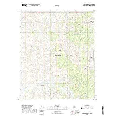
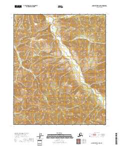
2018 Map of Charley River A-1 SE
USGS Topo · Published 2018About this map
The Tatonduk River flows through the southern reaches of this interior Alaskan landscape, a region defined by its high-latitude ridges and glacial drainage patterns within the Yukon-Charley Rivers National Preserve. The terrain is punctuated by significant elevations including Nimrod Peak, Squaw Mtn, and the prominent Jones Ridge along the northern boundary. A notable geological landmark, the Natural Bridge, is situated near the center of the sheet, suggesting a complex erosional history in the local bedrock. Numerous waterways such as Hardluck Cr, Pleasant Cr, and Pass Cr carve through the deep valleys between these peaks. Positioned against the eastern edge of the United States Of America, the map illustrates a segment of the remote borderlands where the subarctic wilderness remains largely undisturbed by modern infrastructure.
Find a feature on this map
18 named features on this map. Tap any name to fly to it.
Don’t see what you’re looking for? This feature index may not catch every label — zoom into the map to look around manually.
Map Details
Editions of this 2018 Charley River A-1 SE Map
This is the sole edition of this map. No revisions or reprints were ever made.
Other maps of this area

1899 · Fortymile
USGS Topo · 1:250,000

1951 · Charley River
USGS Topo · 1:250,000

1951 · Eagle
USGS Topo · 1:250,000

1956 · Charley River A-1
USGS Topo · 1:63,360

1956 · Charley River
USGS Topo · 1:250,000
1956 · Eagle D-1
USGS Topo · 1:63,360

1957 · Eagle
USGS Topo · 1:250,000
2018 · Charley River A-1 NE
USGS Topo · 1:25,000
2018 · Charley River A-1 SW
USGS Topo · 1:25,000
2018 · Charley River A-1 NW
USGS Topo · 1:25,000