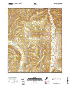
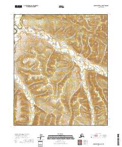
2018 Map of Charley River A-3 NW
USGS Topo · Published 2018About this map
Yukon-Charley Rivers National Preserve encompasses the vast majority of this interior Alaskan landscape, which remains largely undeveloped and defined by its drainage systems. The terrain is anchored in the southeast by the prominence of Strawberry Dome, while a network of waterways including Fisher Cr, Washington Cr, and Nugget Cr carve through the high country. These creeks represent the intricate hydrology of the Yukon River basin, where seasonal flows and drainage patterns dictate movement through the subarctic wilderness. This 2018 survey documents the area as part of a protected federal landscape, emphasizing natural landmarks over human settlement. The presence of Surprise Cr and Eagle Cr further illustrates the complex watershed that characterizes the northeastern reach of the Fairbanks census area, where topography and water are the primary features of record.
Find a feature on this map
12 named features on this map. Tap any name to fly to it.
Don’t see what you’re looking for? This feature index may not catch every label — zoom into the map to look around manually.
Map Details
Editions of this 2018 Charley River A-3 NW Map
This is the sole edition of this map. No revisions or reprints were ever made.
Other maps of this area

1951 · Charley River
USGS Topo · 1:250,000

1956 · Charley River A-4
USGS Topo · 1:63,360

1956 · Charley River B-3
USGS Topo · 1:63,360

1956 · Charley River A-3
USGS Topo · 1:63,360

1956 · Charley River B-4
USGS Topo · 1:63,360

1956 · Charley River
USGS Topo · 1:250,000
2018 · Charley River B-3 SW
USGS Topo · 1:25,000
2018 · Charley River B-3 SE
USGS Topo · 1:25,000
2018 · Charley River A-3 NE
USGS Topo · 1:25,000
2018 · Charley River A-4 NE
USGS Topo · 1:25,000