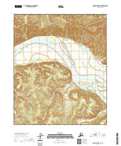
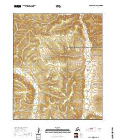
2018 Map of Charley River B-3 SE
USGS Topo · Published 2018About this map
The Yukon River dominates this portion of the interior wilderness, carving a wide path through the Yukon-Charley Rivers National Preserve. This 2018 survey captures the intricate braided channels and river bars of the Yukon as it flows past the foot of the Mertie Mountains. The terrain transitions from the high, rocky elevations of the mountains down to the marshy lowlands and wetlands that define the river valley. Numerous tributaries, including Glenn Creek and Logan Creek, drain the surrounding slopes, reflecting a landscape shaped entirely by its hydrology. The absence of roads or permanent settlements emphasizes the protected and primitive character of this region, where the primary marks on the land are the natural watercourses and the established boundaries of the national preserve.
Find a feature on this map
11 named features on this map. Tap any name to fly to it.
Don’t see what you’re looking for? This feature index may not catch every label — zoom into the map to look around manually.
Map Details
Editions of this 2018 Charley River B-3 SE Map
This is the sole edition of this map. No revisions or reprints were ever made.
Other maps of this area

1951 · Charley River
USGS Topo · 1:250,000

1956 · Charley River B-3
USGS Topo · 1:63,360

1956 · Charley River B-2
USGS Topo · 1:63,360

1956 · Charley River A-3
USGS Topo · 1:63,360

1956 · Charley River A-2
USGS Topo · 1:63,360

1956 · Charley River
USGS Topo · 1:250,000
2018 · Charley River B-3 SW
USGS Topo · 1:25,000
2018 · Charley River A-2 NW
USGS Topo · 1:25,000
2018 · Charley River A-3 NE
USGS Topo · 1:25,000
2018 · Charley River A-3 NW
USGS Topo · 1:25,000