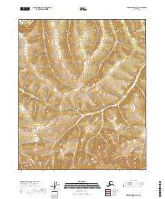
2018 Map of Charley River A-4 SW
USGS Topo · Published 2018About this map
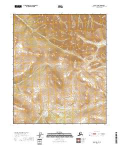
The Yukon-Charley-Rivers National Preserve dominates this section of the Alaskan interior, situated across the boundary of the Southeast Fairbanks and Yukon-Koyukuk census areas. The terrain is defined by a dense network of high-elevation drainages that feed into larger regional systems. Notably, the Charity River and Uncompahgre Cr carve through the northern sections, while smaller tributaries like Orthmer Cr and Nora Cr flow through the southern reaches. This 2018 survey illustrates the complex hydrology of the subarctic landscape, where watercourses such as Fisher Cr and Draughn Cr serve as the primary landmarks in an area devoid of roads or permanent settlements. The map provides a detailed record of the natural topography within this federally protected wilderness.
Find a feature on this map
19 named features on this map. Tap any name to fly to it.
Don’t see what you’re looking for? This feature index may not catch every label — zoom into the map to look around manually.
Map Details
Editions of this 2018 Charley River A-4 SW Map
This is the sole edition of this map. No revisions or reprints were ever made.
Other maps of this area

1951 · Charley River
USGS Topo · 1:250,000

1951 · Eagle
USGS Topo · 1:250,000

1956 · Charley River A-5
USGS Topo · 1:63,360

1956 · Charley River A-4
USGS Topo · 1:63,360

1956 · Charley River
USGS Topo · 1:250,000
1956 · Eagle D-5
USGS Topo · 1:63,360
1956 · Eagle D-4
USGS Topo · 1:63,360

1957 · Eagle
USGS Topo · 1:250,000
2018 · Eagle D-4 NW
USGS Topo · 1:25,000
2018 · Eagle D-5 NE
USGS Topo · 1:25,000