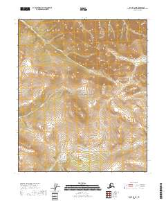
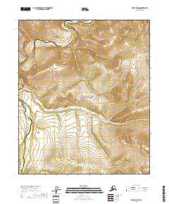
2018 Map of Eagle D-5 NE
USGS Topo · Published 2018About this map
The Yukon-Charley Rivers National Preserve occupies a significant portion of this landscape, showcasing the interior Alaskan wilderness as it was documented in 2018. The map details a complex hydrographic system defined by the Seventymile River in the northeastern quadrant and several key tributaries that drain the surrounding uplands. These include the winding paths of Essie Cr and Hosford Cr, which flow through the central townships, while Godge Cr marks the southern terrain. This topographic survey captures the area within the Southeast Fairbanks Census Area, illustrating the raw topography and township boundaries of T2N R22E and T2N R23E, providing an essential record for those studying the preservation of this remote river corridor.
Find a feature on this map
9 named features on this map. Tap any name to fly to it.
Don’t see what you’re looking for? This feature index may not catch every label — zoom into the map to look around manually.
Map Details
Editions of this 2018 Eagle D-5 NE Map
This is the sole edition of this map. No revisions or reprints were ever made.
Other maps of this area

1951 · Charley River
USGS Topo · 1:250,000

1951 · Eagle
USGS Topo · 1:250,000

1956 · Charley River A-5
USGS Topo · 1:63,360

1956 · Charley River A-4
USGS Topo · 1:63,360

1956 · Charley River
USGS Topo · 1:250,000
1956 · Eagle D-5
USGS Topo · 1:63,360
1956 · Eagle D-4
USGS Topo · 1:63,360

1957 · Eagle
USGS Topo · 1:250,000
2018 · Eagle D-5 SW
USGS Topo · 1:25,000
2018 · Eagle D-5 NW
USGS Topo · 1:25,000