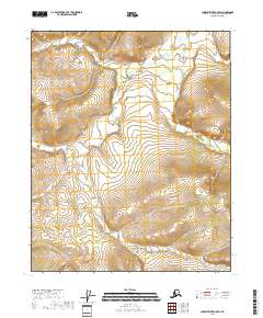
2018 Map of Charley River C-5 SW
USGS Topo · Published 2018About this map
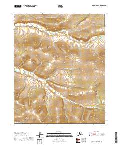
Little Black River winds through this interior Alaskan wilderness, as mapped in a 2018 U.S. Geological Survey project. The landscape is defined by the high-relief topography of the Yukon-Koyukuk region, where the terrain shifts from lower river valleys to ridges exceeding 2,100 feet in the southeastern corner. This survey details the complex hydrography and wetland systems adjacent to the Little Black River, providing an essential reference for the vast, roadless stretches of the Charley River drainage. The map preserves the Public Land Survey System (PLSS) grid, documenting township boundaries including T9N R20E and T8N R22E in a region where physical landmarks are the primary means of orientation.
Find a feature on this map
5 named features on this map. Tap any name to fly to it.
Don’t see what you’re looking for? This feature index may not catch every label — zoom into the map to look around manually.
Map Details
Editions of this 2018 Charley River C-5 SW Map
This is the sole edition of this map. No revisions or reprints were ever made.
Other maps of this area

1951 · Charley River
USGS Topo · 1:250,000

1956 · Charley River C-5
USGS Topo · 1:63,360

1956 · Charley River C-6
USGS Topo · 1:63,360

1956 · Charley River B-6
USGS Topo · 1:63,360

1956 · Charley River B-5
USGS Topo · 1:63,360

1956 · Charley River
USGS Topo · 1:250,000
2018 · Charley River C-5 NW
USGS Topo · 1:25,000
2018 · Charley River C-6 NE
USGS Topo · 1:25,000
2018 · Charley River B-5 NE
USGS Topo · 1:25,000
2018 · Charley River C-5 SE
USGS Topo · 1:25,000