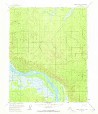
1956 Map of Charley River C-6
USGS Topo · Published 1972About this map
The Yukon River dominates this interior Alaskan landscape, winding through a corridor of low-lying wetlands and complex braided channels. Surveyed in the mid-1950s, the map reveals a remote territory where human presence is nearly non-existent, marked only by a solitary Cabin situated along the northern bank. Tributaries such as Paddle Creek and Fourteenmile Creek drain the interior uplands, cutting through terrain that reaches prominent elevations like the VABM Yukon 18 2505 triangulation station. The mapping reflects the transition from early aerial photogrammetric methods to refined field annotations, capturing the hydrological patterns of the river valley before more modern development or environmental shifts. This specific quadrant illustrates the vast, unpeopled character of the Yukon-Koyukuk region during the post-war era of Alaskan territorial mapping.
Find a feature on this map
5 named features on this map. Tap any name to fly to it.
Don’t see what you’re looking for? This feature index may not catch every label — zoom into the map to look around manually.
Map Details
Editions of this 1956 Charley River C-6 Map
2 editions found
Other maps of this area

1951 · Charley River
USGS Topo · 1:250,000

1951 · Circle
USGS Topo · 1:250,000

1955 · Circle B-1
USGS Topo · 1:63,360

1955 · Circle D-1
USGS Topo · 1:63,360

1955 · Circle C-1
USGS Topo · 1:63,360

1955 · Circle
USGS Topo · 1:250,000
1956 · Charley River D-5
USGS Topo · 1:63,360

1956 · Charley River C-5
USGS Topo · 1:63,360

1956 · Charley River C-6
USGS Topo · 1:63,360

1956 · Charley River B-6
USGS Topo · 1:63,360