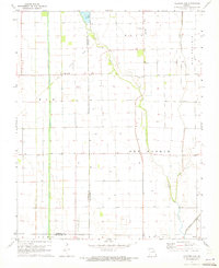
1971 Map of Charter Oak
USGS Topo · Published 1973About this map
Charter Oak sits at the heart of this Bootheel landscape, a region defined by its intensive drainage systems and agricultural layout as it appeared in the early 1970s. The terrain transitions from the elevations of Big Ridge and Elk into the expansive Big Prairie, where the Little River and man-made channels like Otter Slough Ditch manage the low-lying wetlands. Evidence of former transportation networks is preserved in the Old Railroad Grade running northwest from the settlement, while the rural social fabric is anchored by the Big Ridge Ch, Pilgrim Rest Ch, and the Big Ridge Sch. Family history is grounded in the Simmons Cem and numerous named wells that dot the grid. A modern touch to this traditional farming area is the Landing Strip and commercial Fish Ponds, illustrating the evolution of Missouri's southern plains.
Find a feature on this map
18 named features on this map. Tap any name to fly to it.
Don’t see what you’re looking for? This feature index may not catch every label — zoom into the map to look around manually.
Map Details
Editions of this 1971 Charter Oak Map
2 editions found
Other maps of this area

1931 · Sikeston
USGS Topo · 1:62,500

1934 · Bloomfield
USGS Topo · 1:62,500

1934 · Sikeston
USGS Topo · 1:62,500

1939 · Bloomfield
USGS Topo · 1:62,500

1939 · Sikeston
USGS Topo · 1:62,500

1939 · New Madrid
USGS Topo · 1:62,500

1940 · Malden
USGS Topo · 1:62,500

1949 · Bloomfield
USGS Topo · 1:62,500

1951 · New Madrid SE
USGS Topo · 1:24,000

1954 · New Madrid
USGS Topo · 1:62,500