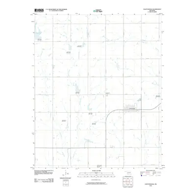
2010 Map of Chattanooga
USGS Topo · Published 2010About this map
The town of Chattanooga serves as the focal point for this Southwest Oklahoma landscape, where the prairie is defined by an extensive system of water management. The surrounding countryside is marked by numerous flood control structures, including Jack Creek Site 1 Dam and Jack Creek Site 9 Dam, which regulate the seasonal flows of Jack Creek and its tributary, East Jack Creek. This network of dams and reservoirs indicates a landscape highly adapted for agricultural stability and water conservation.
Find a feature on this map
36 named features on this map. Tap any name to fly to it.
Don’t see what you’re looking for? This feature index may not catch every label — zoom into the map to look around manually.
Map Details
Editions of this 2010 Chattanooga Map
This is the sole edition of this map. No revisions or reprints were ever made.
Other maps of this area

1937 · Cache
USGS Topo · 1:48,000

1942 · Cache
USGS Topo · 1:62,500

1950 · Snyder
USGS Topo · 1:62,500

1955 · Lawton
USGS Topo · 1:250,000

1956 · Post Oak Creek
USGS Topo · 1:24,000
1956 · Taupa
USGS Topo · 1:24,000

1956 · Indiahoma
USGS Topo · 1:24,000
1956 · Cache
USGS Topo · 1:62,500

1956 · Snyder
USGS Topo · 1:62,500

1962 · Chattanooga
USGS Topo · 1:62,500