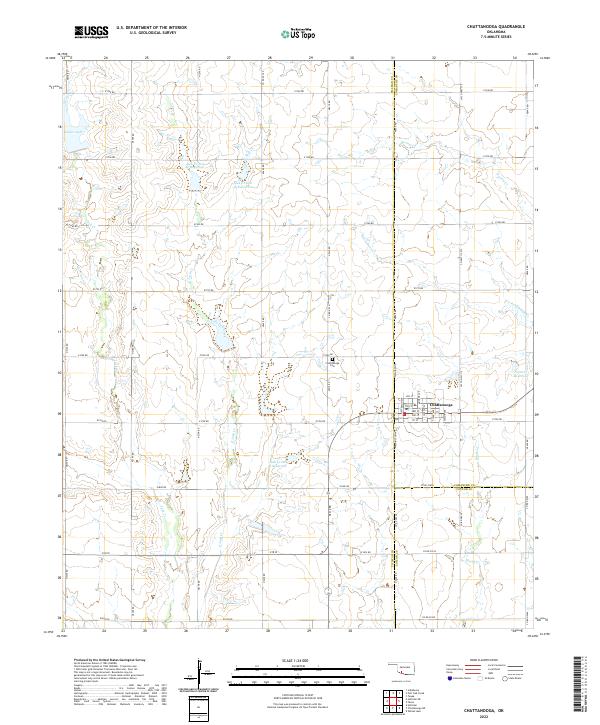
2022 Map of Chattanooga
USGS Topo · Published 2022About this map
Chattanooga serves as the primary hub of this agricultural landscape, situated at the meeting point of Comanche, Tillman, and Cotton counties. The town's grid is detailed with street names like Washington Ave and Monroe Ave, while the surrounding countryside is defined by a strictly surveyed section-line road system. A sophisticated water management network is visible throughout the terrain, featuring several numbered impoundments such as Jack Cr Site 2a Reservoir and Jack Cr-Site 9 Reservoir along the branches of Jack Cr. To the north of the town site, the Chattanooga Cem provides a point of interest for genealogists tracing local families. The land is drained by a series of creeks, including Persimmon Cr and Brush Cr, which cut through the high plains of southwestern Oklahoma.
Find a feature on this map
57 named features on this map. Tap any name to fly to it.
Don’t see what you’re looking for? This feature index may not catch every label — zoom into the map to look around manually.
Map Details
Editions of this 2022 Chattanooga Map
This is the sole edition of this map. No revisions or reprints were ever made.
Other maps of this area

1937 · Cache
USGS Topo · 1:48,000

1942 · Cache
USGS Topo · 1:62,500

1950 · Snyder
USGS Topo · 1:62,500

1955 · Lawton
USGS Topo · 1:250,000

1956 · Post Oak Creek
USGS Topo · 1:24,000
1956 · Taupa
USGS Topo · 1:24,000

1956 · Indiahoma
USGS Topo · 1:24,000
1956 · Cache
USGS Topo · 1:62,500

1956 · Snyder
USGS Topo · 1:62,500

1962 · Chattanooga
USGS Topo · 1:62,500