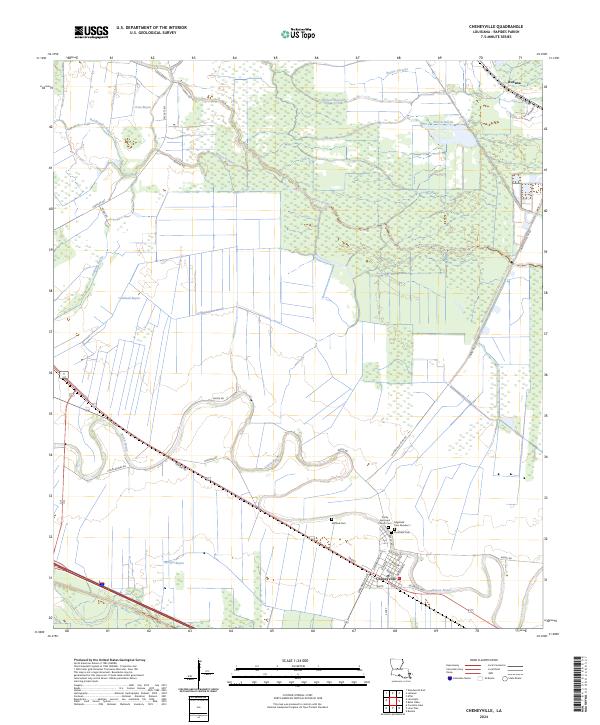
2024 Map of Cheneyville
USGS Topo · Published 2024About this map
The town of Cheneyville serves as the focal point of this Rapides Parish landscape, situated where the Jefferson Hwy and a network of local streets like Greenwood Ave and Front St intersect with the winding course of Bayou Boeuf. The area's local history is anchored by several burial grounds, including Stafford Cem, Edgefield Cem Number 1, and Christians Cem, alongside the Trinity Episcopal Church. North of town, the terrain is defined by a dense system of waterways such as Bayou Rouge, Wilson Bayou, and Bayou Current. Large portions of the territory are dedicated to conservation, with the Grand Cote National Wildlife Refuge and Lake Ophelia National Wildlife Refuge marking the northern and southern reaches of the map respectively. The survey also identifies the smaller settlement of Roxana in the northeastern corner near Beauregard Rd.
Find a feature on this map
49 named features on this map. Tap any name to fly to it.
Don’t see what you’re looking for? This feature index may not catch every label — zoom into the map to look around manually.
Map Details
Editions of this 2024 Cheneyville Map
This is the sole edition of this map. No revisions or reprints were ever made.
Other maps of this area

1935 · Turkey Creek
USGS Topo · 1:62,500

1935 · Lecompte
USGS Topo · 1:62,500

1940 · Marksville
USGS Topo · 1:62,500

1948 · Bunkie
USGS Topo · 1:62,500

1949 · Turkey Creek
USGS Topo · 1:62,500

1952 · Lake Charles
USGS Topo · 1:250,000

1953 · Alexandria
USGS Topo · 1:250,000

1954 · Lake Charles
USGS Topo · 1:250,000

1955 · Alexandria
USGS Topo · 1:250,000

1957 · Lecompte
USGS Topo · 1:62,500