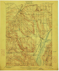
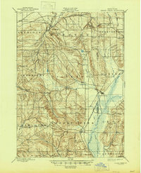
1900 Map of Cherry Creek
USGS Topo · Published 1912About this map
Forestville and Cherry Creek anchor this survey of the western New York plateau at the turn of the century, where the steep hillsides of Arkwright and Villenova give way to the broad valley of Johnson Creek. The landscape is defined by the heavy infrastructure of the Erie R R, with its Allegheny Division and Buffalo and Southwestern Branch threading through the lowlands to connect remote rural hamlets like Smiths Mills Sta. and South Dayton. Small settlements such as Hamlet and Charlotte Center are perched along the tributaries of Walnut Creek, illustrating a classic pattern of upland agriculture and valley-floor rail transit. A prominent Drainage Ditch in the southeast suggests early efforts to reclaim the marshy bottomlands of the Conewango and Leon borderlands for farming.
Find a feature on this map
47 named features on this map. Tap any name to fly to it.
Don’t see what you’re looking for? This feature index may not catch every label — zoom into the map to look around manually.
Map Details
Editions of this 1900 Cherry Creek Map
6 editions found
Other maps of this area

1899 · Silver Creek
USGS Topo · 1:62,500

1900 · Dunkirk
USGS Topo · 1:62,500

1900 · Cherry Creek
USGS Topo · 1:62,500

1904 · Chautaqua
USGS Topo · 1:62,500

1905 · Jamestown
USGS Topo · 1:62,500

1905 · Eden
USGS Topo · 1:62,500

1907 · Eden
USGS Topo · 1:62,500

1922 · Randolph
USGS Topo · 1:62,500

1923 · Randolph
USGS Topo · 1:62,500

1923 · Cattaraugus
USGS Topo · 1:62,500