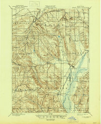
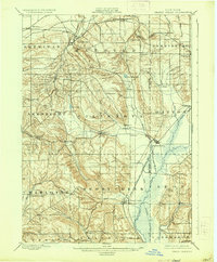
1900 Map of Cherry Creek
USGS Topo · Published 1945About this map
Forestville and Cherry Creek anchor this late 19th-century landscape, which spans the boundary between Chautauqua Co. and Cattaraugus Co. in Western New York. The topography is defined by the plateau's complex drainage, where headwaters like Canadaway Creek and Walnut Creek flow toward Lake Erie, while Conewango Creek moves south toward the Allegheny. The arrival of the Erie R. R. transformed the region's economy, supporting small rail hubs at South Dayton and Smiths Mills Sta.
Find a feature on this map
50 named features on this map. Tap any name to fly to it.
Don’t see what you’re looking for? This feature index may not catch every label — zoom into the map to look around manually.
Map Details
Editions of this 1900 Cherry Creek Map
6 editions found
Other maps of this area

1899 · Silver Creek
USGS Topo · 1:62,500

1900 · Dunkirk
USGS Topo · 1:62,500

1900 · Cherry Creek
USGS Topo · 1:62,500

1904 · Chautaqua
USGS Topo · 1:62,500

1905 · Jamestown
USGS Topo · 1:62,500

1905 · Eden
USGS Topo · 1:62,500

1907 · Eden
USGS Topo · 1:62,500

1922 · Randolph
USGS Topo · 1:62,500

1923 · Randolph
USGS Topo · 1:62,500

1923 · Cattaraugus
USGS Topo · 1:62,500