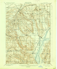
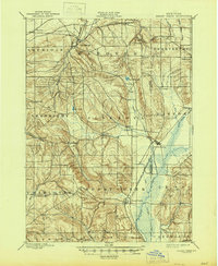
1900 Map of Cherry Creek
USGS Topo · Published 1935About this map
Forestville and the village of Cherry Creek anchor this late 19th-century landscape at the boundary of Chautauqua and Cattaraugus counties. The topography is defined by the complex drainages of Silver Creek flowing north toward Lake Erie and Conewango Creek moving south through the marshy lowlands of Leon. A notable piece of infrastructure is the Drainage Ditch cut through the wetlands south of South Dayton, reflecting early efforts to manage the water table for agriculture.
Find a feature on this map
48 named features on this map. Tap any name to fly to it.
Don’t see what you’re looking for? This feature index may not catch every label — zoom into the map to look around manually.
Map Details
Editions of this 1900 Cherry Creek Map
6 editions found
Other maps of this area

1899 · Silver Creek
USGS Topo · 1:62,500

1900 · Dunkirk
USGS Topo · 1:62,500

1900 · Cherry Creek
USGS Topo · 1:62,500

1904 · Chautaqua
USGS Topo · 1:62,500

1905 · Jamestown
USGS Topo · 1:62,500

1905 · Eden
USGS Topo · 1:62,500

1907 · Eden
USGS Topo · 1:62,500

1922 · Randolph
USGS Topo · 1:62,500

1923 · Randolph
USGS Topo · 1:62,500

1923 · Cattaraugus
USGS Topo · 1:62,500