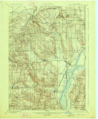
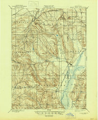
1900 Map of Cherry Creek
USGS Topo · Published 1925About this map
The hills of Chautauqua Co. and Cattaraugus Co. are deeply incised by the headwaters of the West Branch and North Branch creeks at the turn of the century. The Erie R. R. (Buffalo and Southwestern Div.) follows the low-lying eastern terrain, connecting the larger hubs of South Dayton and Cherry Creek. This landscape is defined by its transition from the rolling uplands of Arkwright and Villenova to the broader valleys of Leon and Conewango. Small rural hamlets like Hamlet and Villenova anchor the interior highlands, while the northern edge is marked by the presence of Forestville and the Smiths Mills Sta. rail stop. A notable Drainage Ditch in the southeast suggests early efforts to manage the marshy lowlands, providing a clear picture of the land's development for agriculture and transport before mid-century changes.
Find a feature on this map
42 named features on this map. Tap any name to fly to it.
Don’t see what you’re looking for? This feature index may not catch every label — zoom into the map to look around manually.
Map Details
Editions of this 1900 Cherry Creek Map
6 editions found
Other maps of this area

1899 · Silver Creek
USGS Topo · 1:62,500

1900 · Dunkirk
USGS Topo · 1:62,500

1900 · Cherry Creek
USGS Topo · 1:62,500

1904 · Chautaqua
USGS Topo · 1:62,500

1905 · Jamestown
USGS Topo · 1:62,500

1905 · Eden
USGS Topo · 1:62,500

1907 · Eden
USGS Topo · 1:62,500

1922 · Randolph
USGS Topo · 1:62,500

1923 · Randolph
USGS Topo · 1:62,500

1923 · Cattaraugus
USGS Topo · 1:62,500