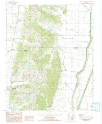
1984 Map of Cherry Valley East
USGS Topo · Published 1993About this map
Crowleys Ridge dominates this Arkansas landscape, providing a narrow band of elevated terrain that dramatically interrupts the surrounding delta lowlands. While the ridge supports several small settlements like Whitehall and Birdeye, the low-lying eastern plains are defined by an intensive drainage network designed for large-scale agriculture. This transition between the loess-capped hills and the bottomlands is marked by engineered watercourses such as the Straight Slough and the Cross County Ditch, which work to manage the seasonal flow of the St. Francis River basin.
Find a feature on this map
25 named features on this map. Tap any name to fly to it.
Don’t see what you’re looking for? This feature index may not catch every label — zoom into the map to look around manually.
Map Details
Editions of this 1984 Cherry Valley East Map
2 editions found
Other maps of this area

1939 · Vanndale
USGS Topo · 1:62,500

1939 · Weiner
USGS Topo · 1:62,500

1940 · Princedale
USGS Topo · 1:62,500

1940 · Dee
USGS Topo · 1:62,500

1953 · Memphis
USGS Topo · 1:250,000

1956 · Memphis
USGS Topo · 1:250,000

1956 · Princedale
USGS Topo · 1:62,500

1958 · Dee
USGS Topo · 1:62,500

1958 · Vanndale
USGS Topo · 1:62,500

1959 · Weiner
USGS Topo · 1:62,500