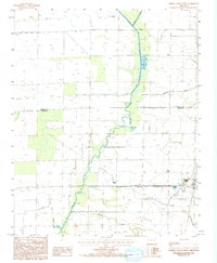
1984 Map of Cherry Valley West
USGS Topo · Published 1993About this map
L'Anguille River meanders through the heart of this Arkansas landscape, defining a complex drainage system that includes Mc Cracken Ditch and Wolf Pen Slough. The settlement of Cherry Valley stands near the eastern edge, showing the town's footprint as it appeared during the early 1980s. The map illustrates a meticulously managed agricultural environment where numerous creeks, such as Hydrick Creek, Cooper Creek, and Prairie Creek, have been integrated into a network of levees and ditches to control the delta waters. A prominent transmission line cuts across the southern portion of the quadrangle, bridging the gap between Wolf Creek and the neighboring rural tracts. This topographic study captures the precise boundary where Poinsett and Cross Counties meet, revealing how the natural waterways and man-made drainage projects have shaped local property lines and land use in this river valley region.
Find a feature on this map
10 named features on this map. Tap any name to fly to it.
Don’t see what you’re looking for? This feature index may not catch every label — zoom into the map to look around manually.
Map Details
Editions of this 1984 Cherry Valley West Map
2 editions found
Other maps of this area

1939 · Vanndale
USGS Topo · 1:62,500

1939 · Weiner
USGS Topo · 1:62,500

1940 · Princedale
USGS Topo · 1:62,500

1940 · Dee
USGS Topo · 1:62,500

1953 · Memphis
USGS Topo · 1:250,000

1956 · Memphis
USGS Topo · 1:250,000

1956 · Princedale
USGS Topo · 1:62,500

1958 · Dee
USGS Topo · 1:62,500

1958 · Vanndale
USGS Topo · 1:62,500

1959 · Weiner
USGS Topo · 1:62,500