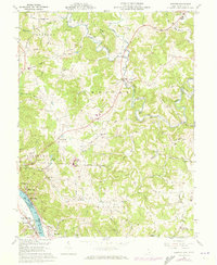
1960 Map of Chester
USGS Topo · Published 1973About this map
Meigs County settlement patterns are deeply defined by the winding course of the Ohio River and the complex drainage of the Shade River system. Along the riverfront, industrial and residential clusters like Minersville, Welshburg, and Syracuse are linked by the B & O RR, showcasing the importance of water and rail transport to the local economy. Further inland, the landscape shifts to a network of smaller communities and rural landmarks. Genealogists will find a high density of family-named sites, including Nease Settlement, and numerous local burial grounds such as Ridenour Cem and Massar and Koenig Cem. This 1960s-era topography reveals a blend of traditional land use and mid-century developments, from the small country churches like Pine Grove Ch to the establishment of the Chester Hill Country Club. Physical evidence of the region's extraction history is present in the form of a Strip Mine and various pipelines.
Find a feature on this map
68 named features on this map. Tap any name to fly to it.
Don’t see what you’re looking for? This feature index may not catch every label — zoom into the map to look around manually.
Map Details
Editions of this 1960 Chester Map
4 editions found
Other maps of this area

1907 · Pomeroy
USGS Topo · 1:62,500

1907 · Keno
USGS Topo · 1:62,500

1908 · Ravenswood
USGS Topo · 1:62,500

1908 · Point Pleasant
USGS Topo · 1:62,500

1926 · Ravenswood
USGS Topo · 1:62,500

1926 · Point Pleasant
USGS Topo · 1:62,500

1928 · Ravenswood
USGS Topo · 1:62,500

1929 · Point Pleasant
USGS Topo · 1:62,500

1947 · Columbus
USGS Topo · 1:250,000

1949 · Clarksburg
USGS Topo · 1:250,000