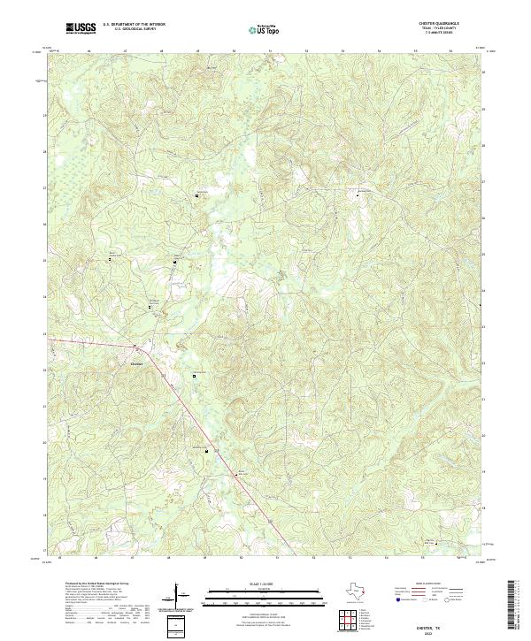
2022 Map of Chester
USGS Topo · Published 2022About this map
Chester serves as the primary hub in this corner of Tyler County, defined by its position along the highway and a sprawling network of creeks. The landscape is deeply tied to local family lineages, as evidenced by the high density of burial grounds scattered throughout the woodlands, including Burch-Caudle Cem, Sterling Cem, and Mahaffey Cem. To the north, the terrain rises toward Big Hill, while the eastern portion of the map is dominated by the Enon Hunting Pasture, a large tract of land indicating the area's ongoing use for timber and recreation.
Find a feature on this map
60 named features on this map. Tap any name to fly to it.
Don’t see what you’re looking for? This feature index may not catch every label — zoom into the map to look around manually.
Map Details
Editions of this 2022 Chester Map
This is the sole edition of this map. No revisions or reprints were ever made.
Other maps of this area

1927 · Lufkin 4-c
USGS Topo · 1:24,000

1928 · Zavalla 3-c
USGS Topo · 1:24,000

1928 · Lufkin 4-d
USGS Topo · 1:24,000

1931 · Zavalla
USGS Topo · 1:62,500

1932 · Manning
USGS Topo · 1:62,500

1953 · Palestine
USGS Topo · 1:250,000

1954 · Beaumont
USGS Topo · 1:250,000

1955 · Woodville
USGS Topo · 1:62,500

1955 · Camden
USGS Topo · 1:62,500

1957 · Beaumont
USGS Topo · 1:250,000