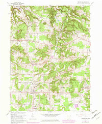
1963 Map of Chesterland
USGS Topo · Published 1979About this map
The Holden Arboretum occupies a significant portion of this Geauga County landscape, punctuated by several named ponds such as Corning Lake and Hourglass Pond. As of the mid-20th-century revision, the area around Chesterland and Chester Center shows the transition from rural crossroads to residential expansion, while maintaining historical landmarks like Fowlers Mill and several local burial grounds, including Center Chardon Cem and All Souls Cemetery.
Find a feature on this map
58 named features on this map. Tap any name to fly to it.
Don’t see what you’re looking for? This feature index may not catch every label — zoom into the map to look around manually.
Map Details
Editions of this 1963 Chesterland Map
3 editions found
Other maps of this area

1904 · Chardon
USGS Topo · 1:62,500

1905 · Garrettsville
USGS Topo · 1:62,500

1905 · Mentor
USGS Topo · 1:62,500

1906 · Chardon
USGS Topo · 1:62,500

1906 · Chagrin Falls
USGS Topo · 1:62,500

1907 · Garrettsville
USGS Topo · 1:62,500

1907 · Mentor
USGS Topo · 1:62,500

1908 · Chagrin Falls
USGS Topo · 1:62,500

1950 · Cleveland
USGS Topo · 1:250,000

1953 · Chardon
USGS Topo · 1:24,000