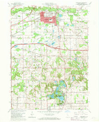
1962 Map of Chesterton
USGS Topo · Published 1964About this map
Chesterton and Porter serve as the primary hubs in this early 1960s study of northwestern Indiana, situated at a critical juncture of industrial transportation and natural drainage. The Little Calumet River and its northern tributary, the Pine River, snake across the northern landscape, while the heavy presence of the New York Central and Baltimore And Ohio railroads underscores the region's importance to the Great Lakes transit corridor. Beyond the town centers, the map reveals a mosaic of early suburban developments such as Meadowbrook, Morgan Park, and Western Acres, alongside older rural landmarks like Tratebas Mill and the Augsburg Ch. To the south, the glacial topography becomes more pronounced, featuring a cluster of water bodies including Wauhob Lake, Spectacle Lake, and Flint Lake, which supported recreational outposts like Blackhawk Beach and the Valparaiso Country Club.
Find a feature on this map
78 named features on this map. Tap any name to fly to it.
Don’t see what you’re looking for? This feature index may not catch every label — zoom into the map to look around manually.
Map Details
Editions of this 1962 Chesterton Map
4 editions found
Other maps of this area

1934 · Porter
USGS Topo · 1:48,000

1940 · Porter
USGS Topo · 1:62,500

1953 · Palmer
USGS Topo · 1:24,000

1953 · Wanatah
USGS Topo · 1:24,000

1953 · Garyton
USGS Topo · 1:24,000

1953 · Westville
USGS Topo · 1:24,000

1953 · Valparaiso
USGS Topo · 1:24,000

1953 · Ogden Dunes
USGS Topo · 1:24,000

1953 · Chesterton
USGS Topo · 1:24,000

1953 · Dune Acres
USGS Topo · 1:24,000