
1953 Map of Chicago
USGS Topo · Published 1964About this map
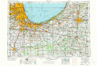
The industrial and academic landscape of the southern Lake Michigan shore is captured in this mid-century survey, revealing a region defined by massive infrastructure and historic institutions. Large-scale industrial operations like the Slag Dump near East Chicago and the Kingsbury Ordnance Plant contrast with the established campuses of Notre Dame University and Valparaiso University. This era shows the early expansion of the regional transportation network, with the Indiana Toll Road, Tri-State Tollway, and Congress Street Expressway cutting through established neighborhoods and rural farmland.
Find a feature on this map
318 named features on this map. Tap any name to fly to it.
Don’t see what you’re looking for? This feature index may not catch every label — zoom into the map to look around manually.
Map Details
Editions of this 1953 Chicago Map
5 editions found
Other maps of this area

1889 · Chicago
USGS Topo · 1:62,500

1890 · Des Plaines
USGS Topo · 1:62,500

1891 · Chicago
USGS Topo · 1:62,500

1891 · Riverside
USGS Topo · 1:62,500

1892 · Joliet
USGS Topo · 1:62,500

1892 · Calumet
USGS Topo · 1:62,500

1892 · Wilmington
USGS Topo · 1:62,500

1893 · Calumet
USGS Topo · 1:62,500

1893 · Riverside
USGS Topo · 1:62,500

1894 · Des Plaines
USGS Topo · 1:62,500