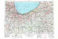
1953 Map of Chicago
USGS Topo · Published 1984About this map
Lake Michigan dominates the northern horizon of this mid-century portrait, where the dense urban grid of Chicago transitions into the industrial heartlands of northwest Indiana and the agricultural plains of Michigan. This 1983 revision shows the mature development of the interstate system, with the Chicago Skyway and Borman Expressway cutting through the complex corridor between Gary and Hammond. The map highlights a significant tension between heavy industry and conservation, represented by the presence of Indiana Dunes National Lakeshore alongside the steel-producing centers of East Chicago. Moving inland, the Valparaiso Moraine provides a geological backbone to the landscape, while the southern reaches reveal specialized conservation areas like the Beaver Lake Prairie Chicken Refuge and the Jasper-Pulaski State Game Preserve, illustrating the region's efforts to preserve native prairie and wetland habitats amidst expanding settlements.
Find a feature on this map
255 named features on this map. Tap any name to fly to it.
Don’t see what you’re looking for? This feature index may not catch every label — zoom into the map to look around manually.
Map Details
Editions of this 1953 Chicago Map
5 editions found

Other maps of this area

1889 · Chicago
USGS Topo · 1:62,500

1890 · Des Plaines
USGS Topo · 1:62,500

1891 · Chicago
USGS Topo · 1:62,500

1891 · Riverside
USGS Topo · 1:62,500

1892 · Joliet
USGS Topo · 1:62,500

1892 · Calumet
USGS Topo · 1:62,500

1892 · Wilmington
USGS Topo · 1:62,500

1893 · Calumet
USGS Topo · 1:62,500

1893 · Riverside
USGS Topo · 1:62,500

1894 · Des Plaines
USGS Topo · 1:62,500