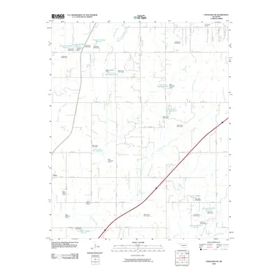
2009 Map of Chickasha NE
USGS Topo · Published 2009About this map
Amber sits at the western edge of this Grady County landscape, where the agricultural plains are defined by an extensive network of water management projects. The 2009 terrain is marked by dozens of small-scale dams and reservoirs, such as Bitter Creek Site 4 Reservoir and Oknoname 051004 Reservoir, which punctuate the drainages of West Bitter Creek and Brushy Creek. This density of numbered dam sites illustrates a highly engineered rural environment designed to manage runoff and support local farming.
Find a feature on this map
67 named features on this map. Tap any name to fly to it.
Don’t see what you’re looking for? This feature index may not catch every label — zoom into the map to look around manually.
Map Details
Editions of this 2009 Chickasha NE Map
This is the sole edition of this map. No revisions or reprints were ever made.
Other maps of this area

1893 · Oklahoma City
USGS Topo · 1:62,500

1893 · Minco
USGS Topo · 1:62,500

1904 · Chickasha
USGS Topo · 1:125,000

1954 · Oklahoma City
USGS Topo · 1:250,000

1956 · Oklahoma City
USGS Topo · 1:62,500

1957 · Oklahoma City
USGS Topo · 1:250,000

1963 · Oklahoma City
USGS Topo · 1:250,000
1965 · Dibble
USGS Topo · 1:24,000
1965 · Blanchard
USGS Topo · 1:24,000
1965 · Oklahoma City SW
USGS Topo · 1:24,000