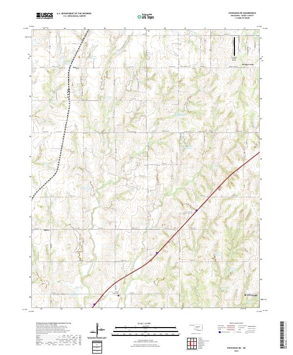
2022 Map of Chickasha NE
USGS Topo · Published 2022About this map
Brushy Creek Cem sits at the heart of this landscape, reflecting the long-standing rural community ties in Grady County. The terrain is defined by an intricate network of waterways and flood-control structures, including Bitter Cr Site 10 Reservoir and Bitter Cr Site 6 Reservoir, which manage the drainage of W Bitter Cr and Brushy Cr. These water management features are central to the region's agricultural character, providing vital infrastructure for the surrounding farms and ranches.
Find a feature on this map
82 named features on this map. Tap any name to fly to it.
Don’t see what you’re looking for? This feature index may not catch every label — zoom into the map to look around manually.
Map Details
Editions of this 2022 Chickasha NE Map
This is the sole edition of this map. No revisions or reprints were ever made.
Other maps of this area

1893 · Oklahoma City
USGS Topo · 1:62,500

1893 · Minco
USGS Topo · 1:62,500

1904 · Chickasha
USGS Topo · 1:125,000

1954 · Oklahoma City
USGS Topo · 1:250,000

1956 · Oklahoma City
USGS Topo · 1:62,500

1957 · Oklahoma City
USGS Topo · 1:250,000

1963 · Oklahoma City
USGS Topo · 1:250,000
1965 · Dibble
USGS Topo · 1:24,000
1965 · Blanchard
USGS Topo · 1:24,000
1965 · Oklahoma City SW
USGS Topo · 1:24,000