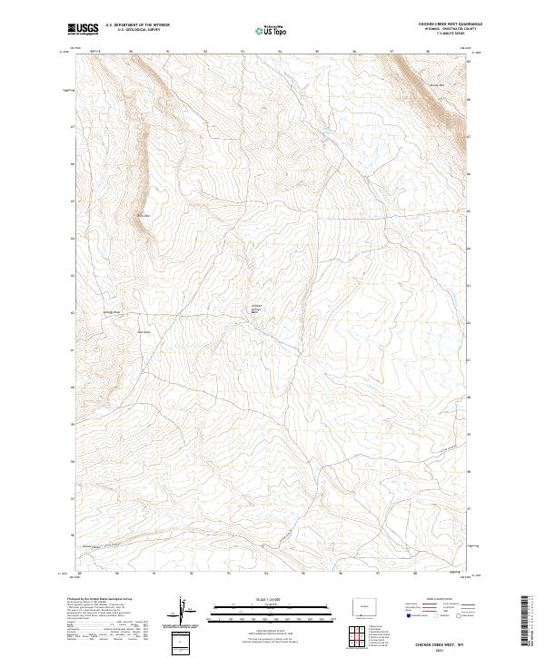
2021 Map of Chicken Creek West
USGS Topo · Published 2021About this map
Kinney Rim and Rifes Rim dominate this high-altitude landscape in Sweetwater County, where the topography is defined by dramatic escarpments and complex drainage systems. The map details a network of ephemeral water sources and seasonal channels, including Chicken Springs and the winding course of Chicken Cr. These features, along with Alkali Cr, suggest a land primarily utilized for livestock grazing and open-range movement, as evidenced by the presence of Bitter Creek Rd skirting the southern draws. Geologists and local historians can trace the specific erosional patterns of Scheggs Draw, East Draw, and Granary Draw, which illustrate the rugged character of this part of the Wyoming interior. The map also clearly delineates the township and range boundaries that have governed land management in this arid region since the original public land surveys.
Find a feature on this map
16 named features on this map. Tap any name to fly to it.
Don’t see what you’re looking for? This feature index may not catch every label — zoom into the map to look around manually.
Map Details
Editions of this 2021 Chicken Creek West Map
This is the sole edition of this map. No revisions or reprints were ever made.
Other maps of this area

1954 · Rock Springs
USGS Topo · 1:250,000

1958 · Rock Springs
USGS Topo · 1:250,000

1962 · Rock Springs
USGS Topo · 1:250,000

1963 · Erickson-Kent Ranch
USGS Topo · 1:24,000

1963 · Scrivner Butte
USGS Topo · 1:24,000

1968 · Chicken Creek East
USGS Topo · 1:24,000
1968 · Chicken Creek SW
USGS Topo · 1:24,000

1968 · Pine Butte
USGS Topo · 1:24,000

1968 · Sand Butte Rim SE
USGS Topo · 1:24,000
1968 · Burley Draw
USGS Topo · 1:24,000