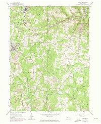
1964 Map of Chicora
USGS Topo · Published 1973About this map
The extractive industrial character of western Pennsylvania is clearly etched into the terrain of Fairview, Bradys Bend, and Donegal townships. This landscape is defined by the extensive presence of Strip Mine operations and numerous gas and oil wells that dot the hillsides between Buffalo Creek and Sugar Creek. The transportation network is built for industry, with the Baltimore and Ohio and Lake Erie and Bessemer railroads following the winding valleys of Bear Creek and Patterson Run.
Find a feature on this map
43 named features on this map. Tap any name to fly to it.
Don’t see what you’re looking for? This feature index may not catch every label — zoom into the map to look around manually.
Map Details
Editions of this 1964 Chicora Map
Other maps of this area

1900 · Kittanning
USGS Topo · 1:62,500

1902 · Kittanning
USGS Topo · 1:62,500

1907 · Foxburg
USGS Topo · 1:62,500

1908 · Foxburg
USGS Topo · 1:62,500

1909 · Butler
USGS Topo · 1:62,500

1910 · Hilliards
USGS Topo · 1:62,500

1911 · Butler
USGS Topo · 1:62,500

1912 · Hilliards
USGS Topo · 1:62,500

1944 · Hilliards
USGS Topo · 1:62,500

1953 · Pittsburgh
USGS Topo · 1:250,000