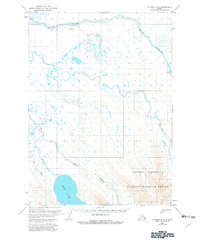
1963 Map of Chignik A-7
USGS Topo · Published 1982About this map
The Alaska Peninsula landscape of the early 1960s is defined by its intricate network of river systems and coastal wetlands. The drainage of the Sandy River and Milky River dominates the northern and central portions of the map, while the expansive Bear Lake and its associated Bear River mark the southern reaches. This remote region, part of a National Wildlife Refuge, shows limited human infrastructure centered around aviation and resource exploration. Isolated facilities like the Sandy River Landing Strip and another Landing Strip near a small cabin provide the primary access to this wetland-rich environment. Evidence of industrial sampling is found at a solitary drill hole, indicating the early assessment of the area's subterranean potential within the larger Peninsula territory.
Find a feature on this map
11 named features on this map. Tap any name to fly to it.
Don’t see what you’re looking for? This feature index may not catch every label — zoom into the map to look around manually.
Map Details
Editions of this 1963 Chignik A-7 Map
3 editions found
Other maps of this area

1951 · Stepovak Bay
USGS Topo · 1:250,000

1953 · Port Moller
USGS Topo · 1:250,000

1963 · Chignik A-6
USGS Topo · 1:63,360
1963 · Chignik B-7
USGS Topo · 1:63,360

1963 · Chignik B-6
USGS Topo · 1:63,360

1963 · Chignik A-7
USGS Topo · 1:63,360

1963 · Stepovak Bay D-6
USGS Topo · 1:63,360

1963 · Port Moller D-2
USGS Topo · 1:63,360

1963 · Chignik
USGS Topo · 1:250,000
1963 · Chignik A-8
USGS Topo · 1:63,360